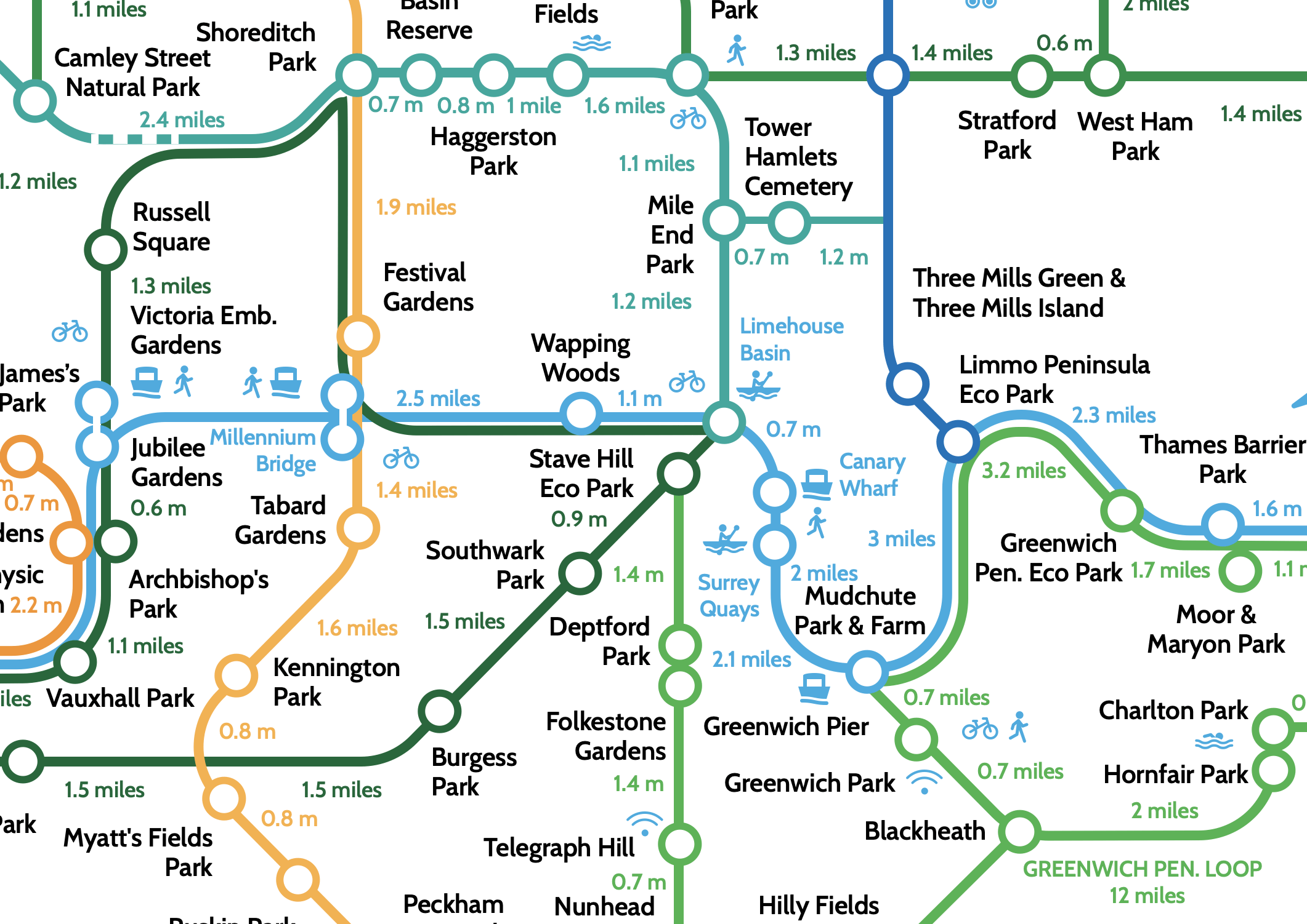
London Greenground Map
Lovely, healthy, and quite the change of perspective with this ‘Tube map for walkers’ which links London’s green spaces. Created by the designer Helen Ilus, the map replaces metro lines with suggested walks and existing trails to take walkers around the city, from parc to parc.
[T]he Greenground Map links up the city’s urban oases: from forests and cemeteries to parks and waterways. Although exact routes aren’t provided, the map does offer distances – an attempt by Ilus to encourage more people to tackle the city on foot.
“London has a great long-distance walking and hiking network, but we also need wider scope for common everyday walking – and to see London as connected by green spaces and waterways, and with links to countryside. Greenground Map aims to change this perception of how we see cities, when walking and cycling longer distances become regular ways to get around.”
We are used to envisioning cities through landmarks, shops, and public transit, it’s always surprising and enlightening to consider the city from a different perspective and this one, especially useful during a pandemic, brings novelty and surprises.

You can see the Ilus’ maps for Edinburgh and Bristol, as well as the full PDF file on her website.
